
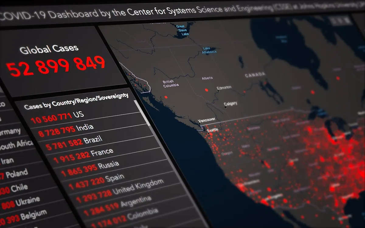
Mapping has undergone a significant transformation over the past few decades. What once relied on static paper charts has evolved into highly interactive digital systems that update in real time. Today, digital maps are no longer just tools for navigation. They serve as powerful platforms that combine location data with analytics, enabling industries to visualize patterns, track changes, and make informed decisions quickly.
In industries such as logistics, urban planning, and environmental monitoring that depend heavily on spatial data, the demand for accurate, dynamic mapping solutions continues to grow. Modern mapping systems integrate multiple data streams, offering insights that go far beyond simple geographic representation. As technology advances, professionals in this field increasingly pursue specialized education better to understand spatial data structures, analytics, and programming.
The Technical Backbone of Modern Spatial Databases
Modern digital mapping relies on sophisticated spatial databases that store and organize vast amounts of geospatial information. These databases are designed to handle location-based queries efficiently, allowing systems to retrieve and display relevant data in real time. Behind every interactive map is a structured framework that supports layering, indexing, and rapid data processing. As mapping applications become more advanced, the underlying systems must also evolve to manage increasing data volume and complexity without compromising performance.
Managing these systems requires a deep understanding of spatial relationships, database architecture, and analytical tools. As mapping technologies advance, organizations increasingly depend on accurate location intelligence to support decision-making. This growing reliance has increased the demand for professionals who can design, manage, and optimize complex spatial systems. To meet these expectations, many individuals pursue a GIS master’s degree to develop expertise in spatial databases, programming, and advanced analytics. Programs such as the one offered by Northwest Missouri State University provide focused training in geospatial technologies, helping learners build practical skills in data management and analysis. This level of education helps bridge the gap between user-friendly interfaces and the technical systems that support them, ensuring that modern mapping solutions remain efficient, scalable, and reliable.
The Foundation of GIS: Vector vs. Raster Data
Geographic Information Systems rely on two primary data formats: vector and raster. Vector data represents discrete features using points, lines, and polygons. This format is commonly used for mapping roads, property boundaries, and infrastructure because it provides precise and scalable representations. It allows analysts to measure distances, define shapes, and perform detailed spatial queries.
Raster data, on the other hand, is composed of grid cells (pixels) and is ideal for representing continuous data. Examples include satellite imagery, elevation models, and temperature distributions. Each cell contains a value that contributes to a larger dataset. Modern GIS platforms often combine both data types, enabling users to analyze detailed features alongside broader environmental patterns. This integration supports more comprehensive and accurate spatial analysis.
Real-Time Data Integration: Powering Live Maps
Real-time data integration is a defining feature of modern digital mapping. Technologies such as GPS, mobile devices, and IoT sensors continuously generate location-based data that feeds into mapping platforms. This constant flow of information enables maps to update instantly, providing users with accurate, up-to-date insights. Applications like traffic monitoring, fleet management, and emergency response depend on this capability.
To support real-time updates, mapping systems use APIs and data-streaming technologies to connect multiple data sources. These systems must process incoming data quickly while maintaining accuracy and consistency. Challenges such as latency, data synchronization, and quality control require advanced technical solutions. Despite these complexities, real-time mapping continues to expand its role across industries, improving efficiency and decision-making processes.
Cloud Computing and Geospatial Processing
Cloud computing has become essential for handling the scale and complexity of modern geospatial data. Traditional systems often struggle to manage large datasets, especially when multiple users need access simultaneously. Cloud platforms solve this issue by offering scalable storage and computing power that can expand as demand increases.
These platforms also enable faster processing of spatial data through distributed systems. Tasks like spatial analysis, rendering, and data integration can run simultaneously across multiple servers. This improves efficiency and allows organizations to work with real-time data without delays or system limitations.
The Role of Remote Sensing in Modern Mapping
Remote sensing technologies play a critical role in collecting accurate geospatial data. Satellites, drones, and LiDAR systems capture detailed information about the Earth’s surface. These tools provide high-resolution imagery that supports mapping across large and often inaccessible areas.
This data improves the precision of digital maps and supports a range of applications. Industries use remote sensing for environmental monitoring, agriculture planning, and infrastructure development. By continuously collecting updated information, these technologies ensure that mapping systems remain accurate and relevant.
UI/UX in Data Visualization: Making Maps User-Friendly
User interface and user experience design are key factors in making digital maps effective. Even the most advanced data is not useful if users cannot easily interpret it. Designers focus on creating intuitive layouts that allow users to interact with spatial data without confusion.
Features such as layering, filtering, and clear visual cues help users navigate complex datasets. Well-designed dashboards present information in a structured way, making it accessible to both technical and non-technical audiences. This balance between functionality and simplicity enhances decision-making across industries.
Predictive Modeling and Spatial Analytics
Predictive modeling uses historical and real-time data to forecast future outcomes. In geospatial technology, this involves analyzing patterns based on location and time. Organizations rely on these insights to plan infrastructure, manage resources, and respond to potential risks.
Advanced models often incorporate machine learning techniques to improve accuracy. These systems can identify trends that are not immediately apparent, such as changes in traffic flow or environmental shifts. By combining spatial data with predictive analytics, businesses and governments can make more informed and proactive decisions.
The Expanding Role of Real-Time Mapping in Modern Industries
Real-time digital mapping continues to reshape how industries operate. From logistics and transportation to environmental conservation, organizations rely on accurate and timely spatial data to improve efficiency. These systems provide immediate insights that support faster decision-making and better resource management.
As demand for geospatial solutions grows, so does the need for professionals who understand both the technology and its applications. Real-time visualization is no longer optional in many sectors. It has become a core component of modern infrastructure, driving innovation and shaping the future of data-driven industries.